The History of the Columbia Street Waterfront District
The Columbia Street Waterfront District has gone by many names–South Brooklyn, Carroll Gardens West, even the awkward CoWaDi for one brief moment–but no matter the moniker, the neighborhood has endured and often thrived in the face of a series of setbacks. In the early 20th century, it was home to a diverse mix of Irish, Italian, and Puerto Rican immigrants, and this vibrant and picturesque neighborhood boasted a lively commercial strip and trolley cars alongside a working waterfront. The area was dealt its first blow by Robert Moses’ trench in the 1950s, followed by the ramifications of a shipping industry that decamped for New Jersey. A plan to level the entire neighborhood in the 1970s for a container port was ultimately scuttled, but a massive sewer project proved a disaster and resulted in vacant lots, dilapidated buildings, and shuttered businesses. It was named a renewal area in the 1980s and thereafter rebuilt itself into the flourishing waterfront community we know today.
Pre-colonial period
The marshland that is the present-day Columbia Waterfront was a part of Lenapehoking—that is, the area occupied by the Lenape people. The Lenape called this particular area Ihepetonga, which meant “high point of sandy soil,” (some dispute this, though, as the land itself is known to be low-lying and the soil to be red clay, hence the eventual Dutch name of Roode Hoeke, later Red Hook). Regardless, it is here that the Lenape hunted, fished, and cultivated crops. Early records from the Dutch West India Company indicate a village by the name of Merechkatviking.
17–18th Centuries
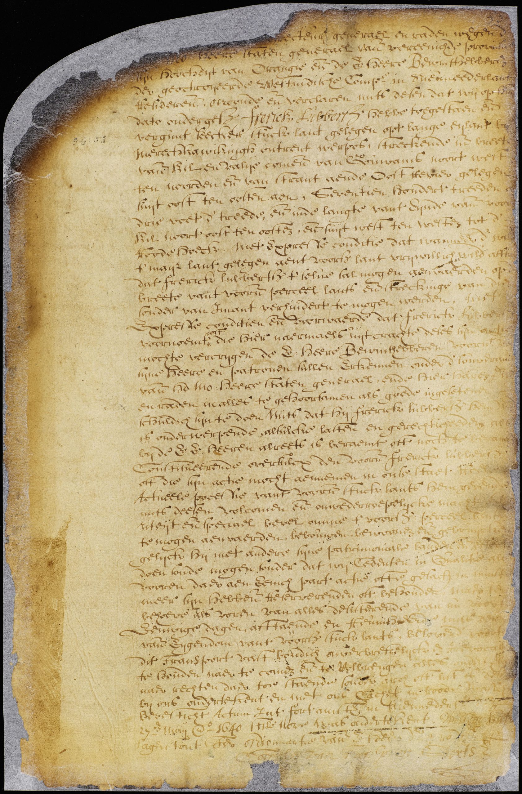
The area saw its first settler in the 1640s, when a Dutchman by the name of Frederick Lubbertsen obtained a patent from Governor Willem Kieft for a piece of land near Merechkawikingh “under the express condition, that if the Indians shall voluntarily give up the corn land in the aforesaid piece, Frerick Lubbersz shall be allowed to enter upon it in the wide and extent of it, without anybody preventing him.” At the time, the land was primarily marshland and meadows, making it ideal for water mills, crops, and grazing animals. Lubbertsen’s farm stretched roughly a mile along the waterfront, from present-day Atlantic Avenue down to Red Hook. And the natives of Merechkawikingh, treated terribly, were ultimately forced from their land and relocated to what is now known as Staten Island.
In 1664, another settler named Adam Brouwer, who ran a grain mill at Gowanus Creek, petitioned the local government to dredge another creek that ran between his own and the East River, so that goods could be transported to the harbor. This canal was marked on a 1767 map as Bull Creek Canal, and was located in what is the present-day entrance to the Battery Tunnel.
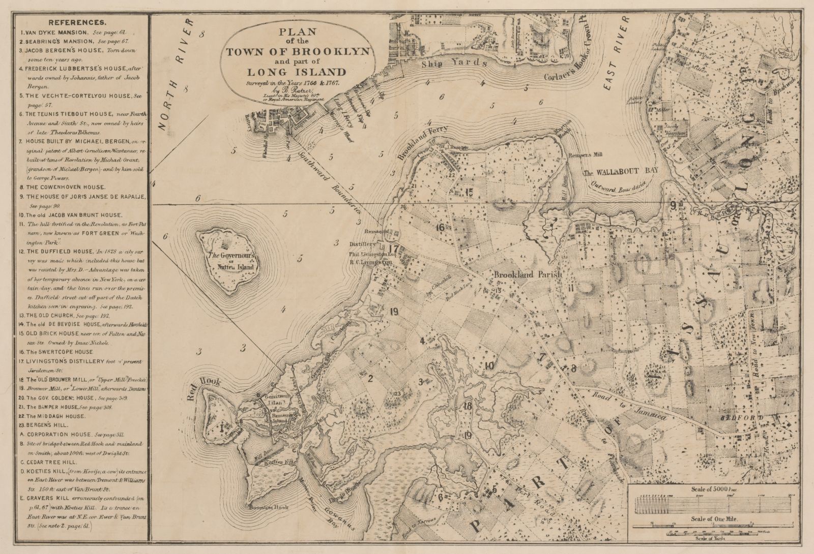
After Lubbertsen’s death in 1680, his land was divided among his family. His second daughter, Aeltje, had married Cornelius Sebring, and he, along with Lubbersten’s step-son Peter, constructed a water mill on a marshy area known as Gravers Kill. The water mill, known as “Sebring’s Mill,” was one of the first industrial structures to grace the waterfront, and processed grain for local farmers. It was situated on the land currently bound by Kane, Degraw, Tiffany, and Columbia Streets.
19th Century
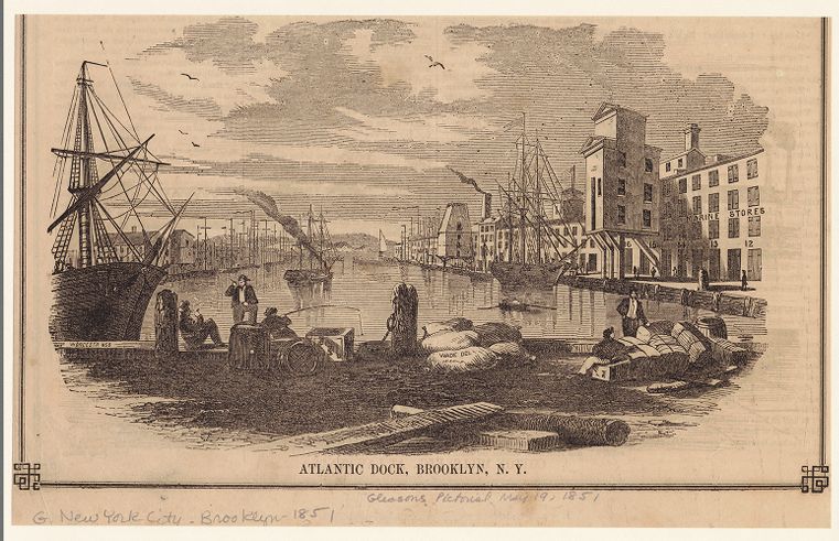
After the War of 1812, as well as the completion of the Erie Canal in 1825, Brooklyn saw a significant increase of immigrants, plus a chance to expand its shipping enterprises. More shipping traffic meant a need for better ports to accommodate the increase in cargo and waterfront activity. As a result, in 1841, the Atlantic Dock Company constructed the manmade Atlantic Basin; workers dredged the coastline at low tide, then filled in and leveled the surrounding marshland with the excavated earth. Whereas before, when the coastline culminated east of Columbia Street, it was extended by nearly a third of a mile. This manmade coast gave rise to Van Brunt Street, which was created entirely on landfill.
The completion of the Atlantic Basin in 1847 transformed the area into one of the world’s busiest cargo ports. And with this active port came further development: docks were constructed starting in 1841, and warehouses in 1844. Throughout the decade, boiler shops, coal yards, foundries, lead works, lumber yards, and machine shops sprung up in the area. From 1848 to 1849, roughly 800 homes, boarding houses, warehouses, and factories were built.
The dockworkers and laborers (mostly Irish immigrants) lived in shanties built from scrap material. Despite the fact that the land had been filled in, the area was still subject to flooding during high tide, owing to poor water control and inadequate landfilling in what had formerly been marshes. In 1856, the City’s Legislative Tenement Committee visited the area. Their report appeared in an August 22nd article titled “How the Squatters Live in Brooklyn” in the New York Times:
But of all the colonies of squatters in Brooklyn, that at the foot of Columbia Street, called “Tinkersville,” is certainly entitled to the palm. A full view of this enchanting spot can be obtained from Hamilton Avenue as it stretches away upon a tongue of land into Gowanus Bay. The Committee passed down its narrow and serpentine street, and inhaled the savory smells puffed forth from the numerous pig styes and cattle stalls on either hand. [. . . ] The ground is said to be owned by F. B. Cutting, Esq. of the City, but no rent is charged those in possession. The cost of erecting a shanty is little or nothing, as the boards are generally stolen; and judging from the presence of a number of lazy-looking men lounging around, the squatters lead a comparatively indolent life. They, however, fat their own pork, raise a few fowls, and supply a portion of Brooklyn with milk. About 150 cows are kept at this place, and fed upon swill from an adjoining distillery. [. . . ] Tinkersville is located not more than two or three feet above high-water mark, and [. . .] is in a most eligible position for an attack of the yellow fever.
Throughout the 1860s, the Atlantic Basin boasted the most extensive and modern facilities. The rise in job opportunities, and the expectation of more development after the Gowanus Canal was completed in 1855, led to another influx of new residents: German, Irish, and Jewish immigrants flooded to the area.
Henry Reed Stiles, in his book The History of Brooklyn, writes that, by 1870, “the hum of machinery and the evidences of industry and activity are unceasing, and this section of the city already possess sufficient material in population, property, manufacturers, schools, churches and other requisites to constitute a tolerable municipality.”
20th Century
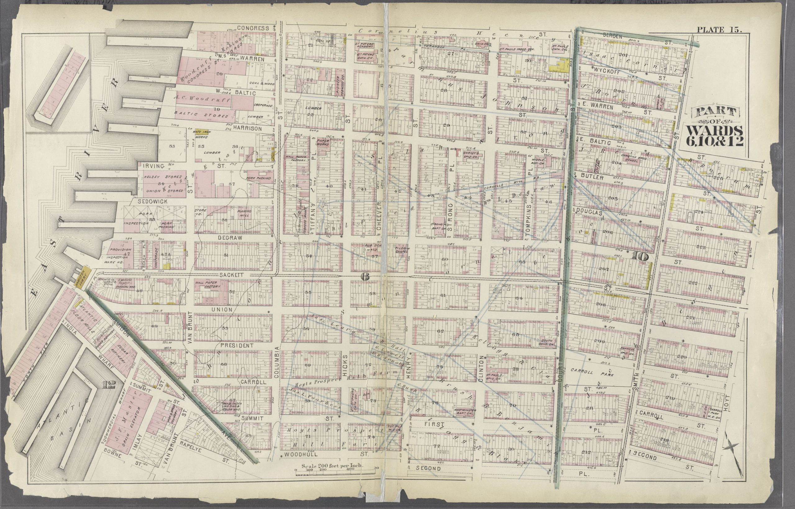
For much of the early twentieth century, the waterfront continued to be a vital industrial zone, bustling with shipping traffic. Nearby, sugar refineries and warehouses provided steady work. The longshoremen and dockworkers built homes east of the docks, along Columbia, Hicks, and Union Streets. Many of them were Irish and Italian, but there was also a large contingent of Puerto Rican immigrants, who had come to the area via the New York and Porto Rico Steamship Company in the early decades of the 20th century. The longshoremen’s unions wielded significant influence. Columbia Street itself was a lively commercial strip, chock full of bakeries, butchers, and bars that catered to dockworkers.
1950s
In the 1950s, two factors contributed to the decline of Brooklyn’s maritime economy: the advent of containerization in 1956, and the shipping industry’s shift to New Jersey’s larger ports. The once bustling docks grew quiet while unemployment surged among countless longshoremen. Consequently, crime and corruption spiked—an environment in which infamous mobster “Crazy” Joe Gallo tried to take over the waterfront crime circuit. He and his crew operated out of 51 President Street, between Columbia and Van Brunt Streets, and he was known to walk his pet lion, Cleo, along the surrounding streets. (Jimmy Breslin later wrote a roman a clef based on his life, titled The Gang That Couldn’t Shoot Straight. In 1970, Jerry Orbach and Robert DeNiro filmed the movie version in the neighborhood.)
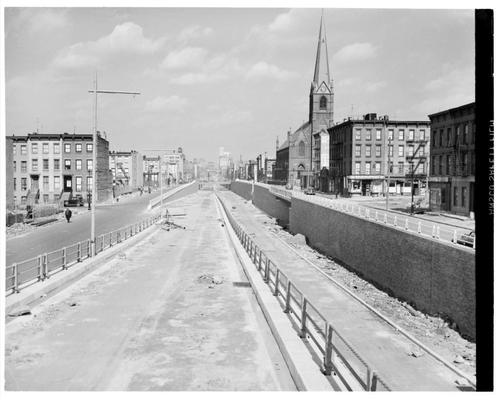
It was in the 1950s that city planner Robert Moses oversaw the digging of a 4,500-foot trench that would later become the six-lane Brooklyn-Queens Expressway. Many buildings along Hicks Street were demolished as a result, and many families were displaced, all under the guise of what Moses deemed “slum clearance.” This trench effectively severed Columbia Street from Carroll Gardens and Cobble Hill, and residents were cut off from schools, transportation, and their community.
On June 29, 1955, the New York Times reported that the Port Authority was in negotiations to purchase the dilapidated waterfront piers from the New York Dock Company (which had taken over the Atlantic Dock Company’s real estate and shipping portfolio).
The entire terminal area of the New York Dock Company reaching southward from the Brooklyn Bridge to the northern edge of Erie Basin is included in negotiations that have been going on for weeks between owners of the property and the bi-state agency [. . .] The purchase would give the Port Authority empire a major slice of the New York waterfront. [. . .] The already vast operations of the authority include port terminal facilities in New Jersey. For years the bi-state agency has sought to enter the New York side of the harbor to balance its Jersey terminal operations. [. . .] In addition to its piers and upland areas, the terminal includes vast warehouses and a pier-serving rail network known as the New York Dock Railway. It is one of three private railroads operating on the Brooklyn waterfront. It has been estimated that the ten-mile Brooklyn shore handles 50 or 60 per cent of all the foreign cargoes that move through the Port of New York, in and out.
The New York Dock Company is the biggest terminal in the port in point of area [. . .] It is considered one of the biggest dockside terminals in the world. [. . .] Some of the terminal’s piers are small, and some of the larger ones are reported to be in need of modernization. The pierhead line established by Federal regulation is fairly close to the shoreline along this part of Brooklyn, and any future construction program would be limited as to extension into the bay. However, the authority has already done major studies in the use of wharves or lateral type piers, and expansion of the terminal area could be achieved along those lines.
In 1956, after the Port Authority’s purchase, the intention was to revitalize the outdated waterfront to a larger, modern one that would accommodate container shipping. In the latter part of the decade, the Port Authority replaced 27 obsolete piers with 12 modern ones. The Port Authority began to procure properties east of the piers to make room for their planned container port.
1960s
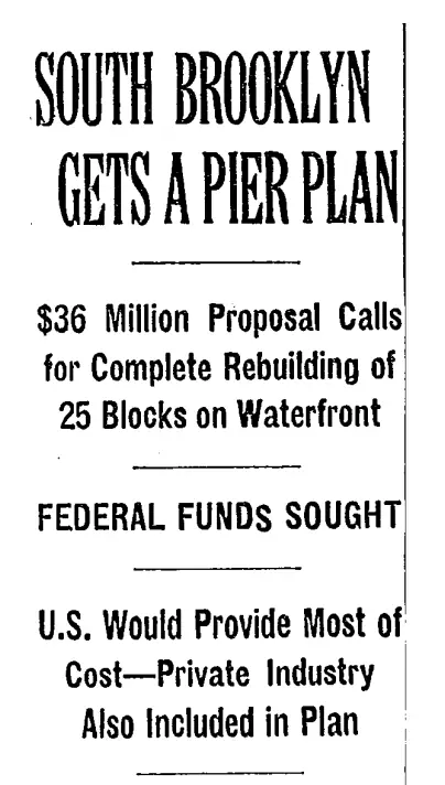
On April 7, 1964, Brooklyn borough president Abe Stark announced a $36 million industrial redevelopment project for the waterfront that would entail leveling 25 blocks of rundown buildings and replacing them with new piers and cargo handling facilities. The plan called for rows of buildings to be erected along the BQE, as well as large sheds for automated cargo handling to be built in the land adjacent to the piers. The proposal included widening Columbia Street to 100 feet to provide an easier connection with the Gowanus Expressway and the BQE.
”So then all the people who owned property there figured why fix it up, the city is just going to tear it down in a few years,” said Salvatore Scotto, president of the Carroll Gardens Association, a civic group.
1970s
Since the Port Authority’s 1956 purchase of the land, the Authority had invested over $100 million in new pier facilities, but they were mainly designed for break bulk (handled piece by piece), not containers. The Authority also claimed that there wasn’t enough land around the piers to store and load containers. In December 1970, $9 million was transferred from the Manhattan waterfront development to the Brooklyn one, with the intention to purchase 41 acres of privately held land around Columbia Street, and to then level 25 blocks to serve as the backup space for the Port Authority. The community would in turn lose 300 housing units and 800 jobs, and there were no plans to provide either housing or jobs for those displaced. (Later they would offer 115 units of low-income housing.) Nor was there a plan to deal with the traffic and pollution caused by an expanded port.
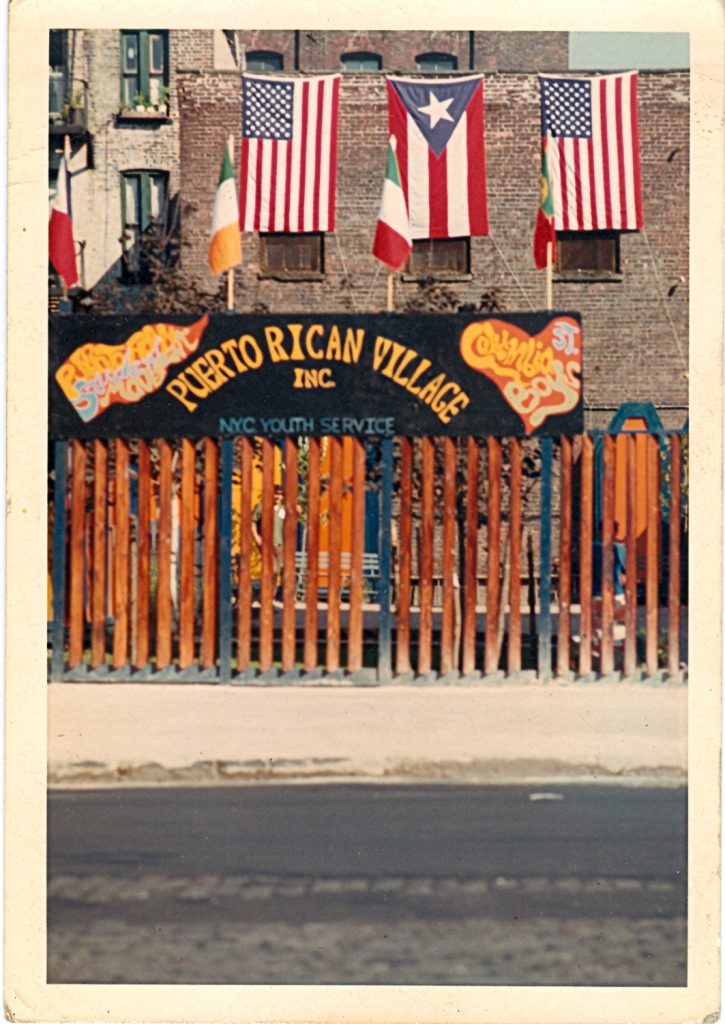
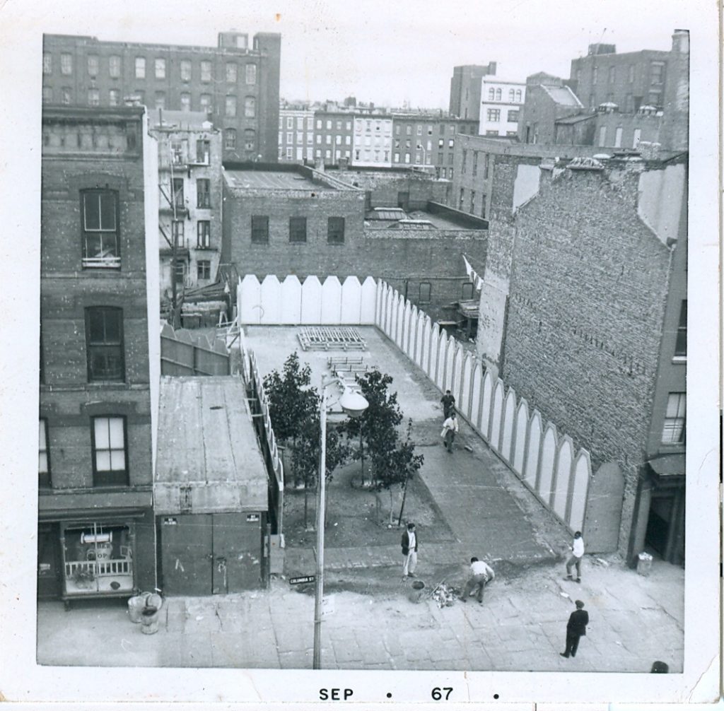
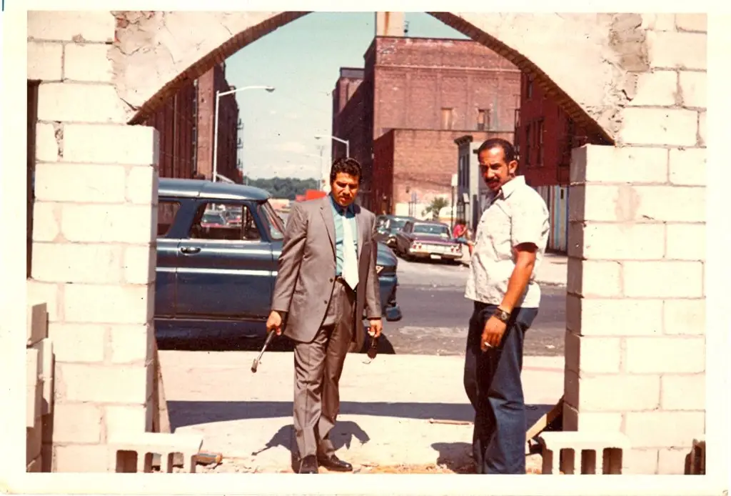
By the 1970s, the neighborhood’s demographics were 60% Puerto Rican, 30% Italian, and 10% African American. La Casa, a local community center, provided counseling and social services, and groups such as Park Row Gardens Buddies Outpost Program and Los Tintos Indios offered support and guidance to locals. Los Tintos Indios had built a community plaza at an abandoned lot at 133 Columbia Street. They called it Puerto Rican Village, and its construction was inspired by Puerto Rico’s 16th-century Fort San Felipe del Morro.
Born out of La Casa was Committee to Save the Waterfront, a group led by a young man named Ramon (or Ray) Requiera (sometimes spelled Regueira, Ruggiera, or Regera). The Committee opposed the city’s plan to raze 25 blocks, essentially the entire neighborhood: from Congress Street down to Hamilton Avenue, from the BQE to Van Brunt Street.
A local organizer, interviewed for a December 17 article in the Village Voice, said of the plan for the neighborhood, “I think the shopkeepers and the homeowners here could sue the city for fraud. For 20 years, they haven’t known what was going to happen to their buildings and haven’t wanted to waste money on repairs. Now it’s deteriorated into a slum, everything is worthless, and the city comes and says, ‘But look, it’s in terrible condition.’”
In an issued statement, the Committee wrote, “The city’s proposal as it stands now literally destroys the oldest Puerto Rican community in the U.S. and one of the oldest Italian communities.” The Committee, working with Pratt’s Center for Community and Environmental Development, offered a counterproposal: locate the containerport at an abandoned site in Red Hook instead; limit the backup space to only 27 acres, rather than 41, and confine it to Atlantic Avenue to the north, Degraw Street to the south, spanning from Van Brunt Street to the BQE, east to west; and build 500 low-income units to offset the displaced homes.
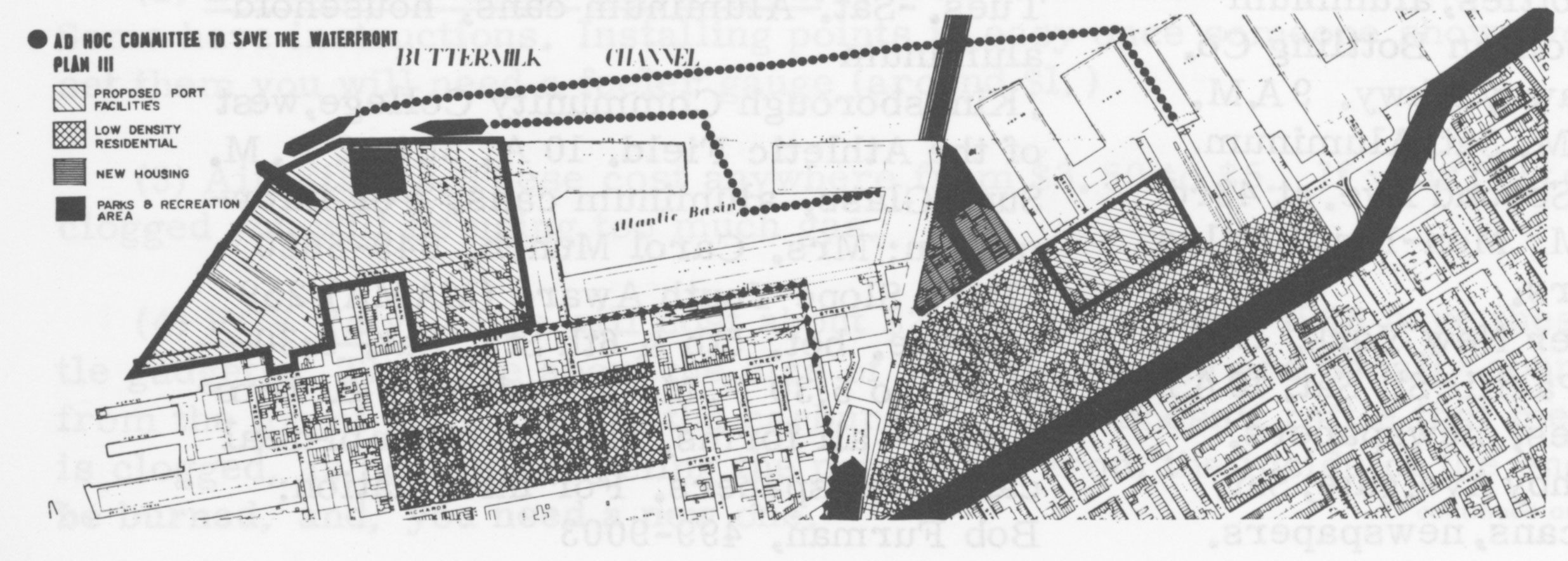
The Committee had the support of the Brooklyn Heights, Cobble Hill, and Carroll Gardens Associations, along with the South Brooklyn Development Council. On October 14, 1971, the City Planning Commission agreed to withhold their decision on 150 units of low-income housing until after the Port Authority completed a feasibility study on the alternative plan.
On March 20, 1972, the City Planning Commission adopted a significantly revised plan for the container port, in part due to objections by the neighborhood’s residents. The thrice-modified plan would span 230 acres and instead curve around Red Hook, with the container port berths lying off Coffey Street. Twenty-four acres of backup loading facilities would begin at Warren Street. Only 100 families would face relocation.
The 50-year lease between the City and Port Authority was executed on October 10, 1974. The City would spend $42 million to acquire 82 acres, adding to Port Authority’s 30.
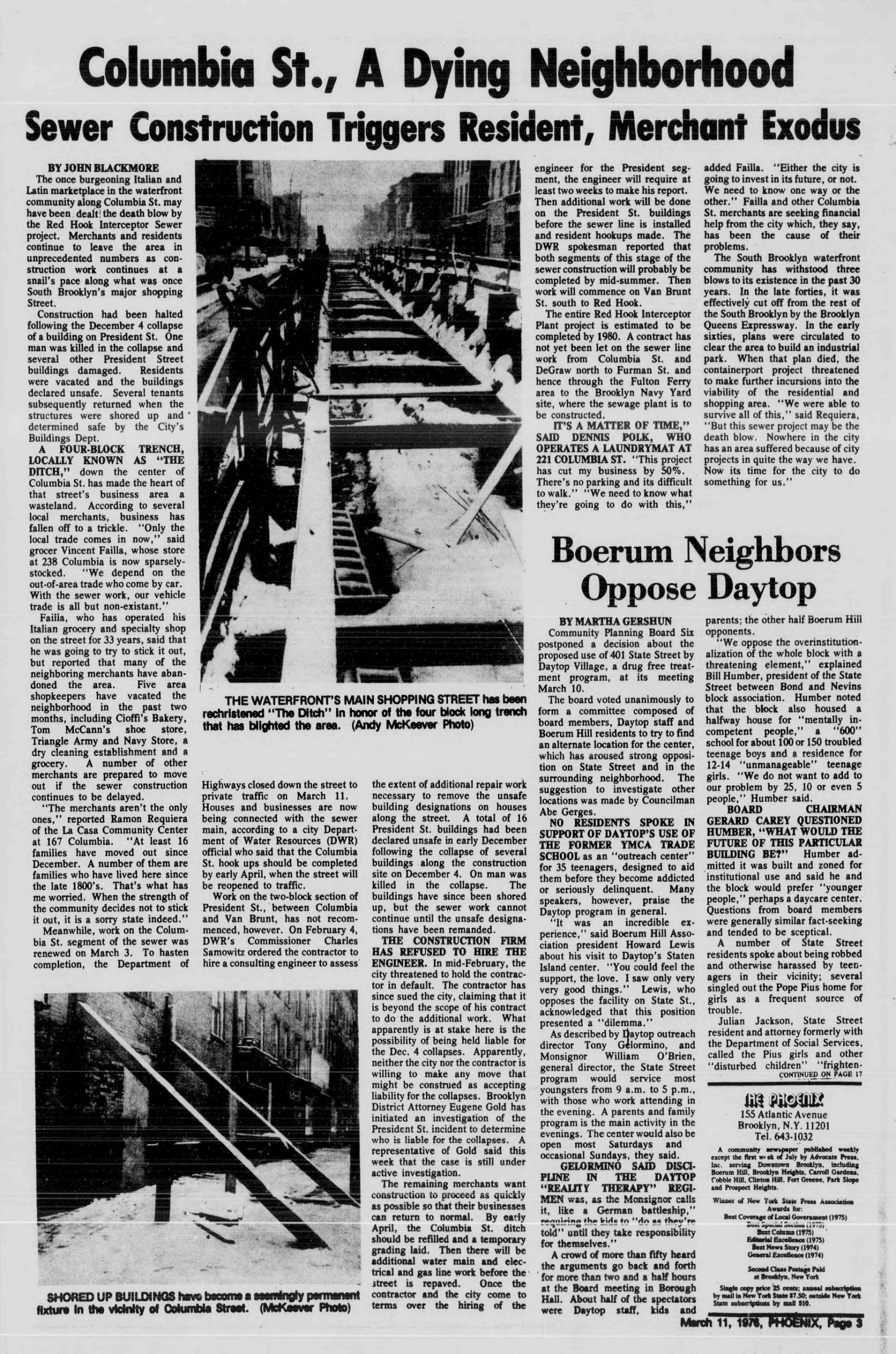
Meanwhile, the Carroll Gardens Association lobbied for a $378 million sewage treatment project that would address the environmental disaster that was the Gowanus Canal. The project would eliminate raw sewage from surrounding waterways. In May 1975, the City broke ground on the 6,200-foot interceptor sewer, which would stretch from Degraw and Columbia Streets down to Van Brunt Street near Erie Basin in Red Hook. The project effectively turned Columbia Street into a ditch, preventing trucks from accessing the area, and local stores closed as a result. The sewer project also had devastating effects on neighboring buildings, where the foundations had already been compromised by digging for the Battery Tunnel and the BQE trench. In December 1975, a house on President Street collapsed, killing one man. In August 1977, a building on Carroll Street collapsed, killing a man and his 8-year-old daughter. In the end, more than 30 buildings were identified as having structural problems and had to be demolished as a precautionary measure. The once thriving neighborhood became riddled with empty lots, collapsing buildings, and shuttered businesses.
In July 1978, Mayor Ed Koch announced a five-point, $62 million “action program” for the South Brooklyn waterfront and Columbia Street area. The five recommendations for redevelopment were:
- commit $17 million to the container port construction;
- restore Columbia Street by way of the construction of 100–160 low-rise housing units, as well as a half-acre park;
- complete the President Street portion of the interceptor sewer project;
- establish plans to safeguard residential buildings from rerouted traffic expected as a result of BQE reconstruction; and
- provide rehabilitation and relocation for all those affected by the revised plan and location of the container port.
The revitalization project also included a feasibility study for adding decking to the BQE trench to unite the east and west portions of Hicks Street. Results from that feasibility study indicated that a deck spanning from Congress to Union Streets would cost $12 million.
In 1979, the City Planning Commission and Port Authority announced a 70-acre container port, centering around Atlantic Basin in Red Hook. A far cry from the sprawling 230-acre facility promised in 1972. The City spent $20 million. The community lost 20 units of housing, 5 businesses, and 200 jobs
1980s
The urban renewal plan for Columbia Street included the construction of 57 two-family homes on Columbia and President Streets, a development later known as Columbia Terrace. Developers were required to sell a third of the apartments, mostly two-bedroom units, to prospective buyers earning no more than $48,000 annually. The City would also rehabilitate 34 units of housing that had been damaged over the years. The City demolished decaying buildings and mandated that any new constructions not exceed three stories. Eleven vacant lots were revitalized as parks, or paved over. In 1986, a former wallpaper factory was transformed into condos at 1 Tiffany Place.
Meanwhile, in 1985, the long-awaited Environmental Impact Statement regarding the proposal to build decking over a portion of the BQE found that doing so would violate air quality control standards. The report found that a deck would create tunnel-like conditions causing high concentrations of carbon monoxide, and a ventilation system would not be possible due to the expressway’s clearance requirements.
1990s
The neighborhood began to see a slow return to its former heyday. Faced with the rising prices in Cobble Hill and Carroll Gardens, artists and young families looked west toward the Columbia Street Waterfront, drawn in by its quiet streets and sweeping waterfront views. Former factories on Tiffany Place were converted to condos. Van Voorhees Park got a makeover to the tune of $873,000. The Department of Transportation announced plans to build a pedestrian and bicycle trail linking Brooklyn Bridge and Red Hook.
21st Century
The early 2000s saw a surge in development. Columbia Gardens, at the corner of Union and Columbia Streets, was an affordable housing development built on one of the last city-owned vacant lots. Vestiges from another time, like Frank’s Department Store and Ferdinando’s Focacceria on Union Street, were joined by newcomers in the form of bakeries, restaurants, and shops.
Consequently, real estate values skyrocketed, and the population increased tenfold.
In a Daily News article published June 22, 2003, Madeleine Murphy, president of Neighbors United for the Columbia Street District, cautioned, “We don’t want to see 30-, 40- or 50-story buildings. We’d like to see contextual housing, something that would fit with what’s already there. . . . Maybe some of the piers could be mixed-use.”
The Bloomberg administration spurred efforts to push the shipping terminal out in favor of housing, a conference center, cruise terminal, and a beer garden along Piers 7–10. However, in 2008, the Port Authority opted to keep it a working port for the remaining years of its lease.
The area’s isolation, once its curse, is now a blessing, because it has allowed the neighborhood to preserve its original charm and to foster a close-knit community within its 25 blocks. The Columbia Street Waterfront District is a testament to how a resilient neighborhood can thrive in the face of adversity, endure neglect and thoughtless city planning, and organize itself to fight for the common good for its denizens.
References
“Area Residents Protest Plan for Brooklyn Piers.” New York Times, August 6, 1971.
Bahrampour, Tara. “Neighborhood Report: Red Hook; On a Street That Once Bustled, New Shops and Bakeries Blossom.” New York Times, April 6, 2003.
Bergen, T. G. The Bergen Family; the Descendants of Hans Hansen Bergen, One of the Early Settlers of New York and Brooklyn, L.I., Vol. 1. Albany: Joel Munsell, 1876. Digitized by the University of Wisconsin, 2007.
Blackmore, John. “Columbia St., A Dying Neighborhood: Sewer Construction Triggers Resident, Merchant Exodus.” The Phoenix, March 11, 1976.
Blumenthal, Ralph. “City Unit Adopts Waterfront Plan.” New York Times, March 21, 1972.
Bonislawski, Adam. “Hooking Up—Once-Dingy Columbia St. Comes into Its Own.” New York Post, August 14, 2004.
Calder, Rich. “City Looks to Revive Columbia Street Waterfront District.” New York Post, February 1, 2011.
Cardwell, Diane. “When the Street Name Outlives the Street; Only Signs Remain to Tell the Story of New York’s Ever-Changing Grid.” New York Times, May 10, 2004.
Carroll, Maurice. “City Revises Disputed Red Hook Port Plan.” New York Times, February 20, 1972.
Ciner, John. “Red Hook Interceptor Project Soon to Be Resumed; Safety a Priority in Aftermath of Collapse.” The Phoenix, August 5, 1976.
de Pue, Stephanie. “Brooklyn waterfront: Berths or Boondoggle?” The Village Voice, December 17, 1970.
Gleber, Linus. “Scores of Red Hook Residents Protest Board Six Proposals.” The Phoenix, June 14, 1979.
Hamlin, Suzanne. “On the Waterfront in Brooklyn, an Enclave Regains Its Energy.” New York Times, May 15, 2005.
Hays, Elizabeth. “Affordable Housing Blooms in Carroll Gardens.” Daily News, February 19, 2003.
Horne, George. “Port Authority to Acquire Vast Brooklyn Dock Area; Port Authority to Buy Terminal.” New York Times, June 29, 1955.
Hudson, Edward. “City Acts to Save Brooklyn Piers.” New York Times, February 28, 1971.
Hutson, Brittany. “By Any Name, Columbia Street District Shows Life.” The Wall Street Journal, June 30, 2010.
“Involvement Is Not Just a Cliche at Pratt.” New York Times, December 12, 1971,
Ivins, Molly. “Red Hook Survives Hard Times into New Era.” New York Times, Nov. 16, 1981.
Lindsey, Robert. “Lease Signed Approving Red Hook Containerport.” New York Times, October 11, 1974.
Montgomery, Paul L. “Environmentalists Stage Pier 6 Bazaar in Brooklyn.” New York Times, May 30, 1972.
“Neighborhoods.” STREET Magazine, Issue I, II, III, October 1971–December 1971, pp.14–15.
Nichols, Mary Peret. “Runnin’ Scared.” The Village Voice, October 21, 1971.
O’Kane, Lawrence. “South Brooklyn Gets a Pier Plan; $36 Million Proposal Calls for Complete Rebuilding of 25 Blocks on Waterfront; Federal Funds Sought; U.S. Would Provide Most of Cost, Private Industry Also Included in Plan.” New York Times, April 8, 1964.
Ortiz, Stephanie. “Puerto Rican Presence in Columbia Street: Community Park Turned Shantytown.” Red Hook Water Stories.
Oser, Alan S. “About Real Estate: Brooklyn’s Columbia St. in the Condominium Era.” New York Times, September 14, 1984.
Oser, Alan S. “Perspectives: Neighborhood Stores; Columbia Street Tips Hat to Commerce.” New York Times, April 14, 1991.
Roth, Eric. “BQE Deck Would Violate Air Pollution Standards.” The Phoenix, February 28, 1985.
Ruiz, Angelina. “Puerto Rican Village Lives On.” New York Magazine, October 1, 2021.
“The Sanitary Condition of the City. LEGISLATIVE TENEMENT COMMITTEE. How the Squatters Live in Brooklyn.” New York Times, August 22, 1856.
Severo, Richard. “City Breaks Ground for Red Hook Sewage Plant.” New York Times, May 15, 1975.
Sexton, Joe. “2 Killed as Fire Destroys Shantytown in Brooklyn.” New York Times, January 4, 1994.
Shelby, Joyce. “Columbia St.’s Gem of a District Again: Split apart in 1950s by BQE project.” Daily News, June 22, 2003.
Stiles, Henry Reed. A History of the City of Brooklyn: including the Old Town and Village of Brooklyn, the Town of Bushwick, and the Village and City of Williamsburgh, 3 vols. Brooklyn: Published by subscription, 1867–1870.
Surfaro, Monica. “Red Hook Residents Critical of City on Relocation.” New York Times, April 20, 1975
Tooker, William Wallace. Indian Names of Places in the Borough of Brooklyn: With Historical and Ethnological Notes. New York: Francis P. Harper, 1901.
Tomasson, Robert E. “Upgrading Moves Ahead in Red Hook.” New York Times, March 2, 1975.
“TV Proxy Protests a Harbor Plan.” New York Times, October 17, 1971.
Vandam, Jeff. “Neighborhood Report: Brownstone Brooklyn; The Newest Entry In Neighborhood Scrabble.” New York Times, March 14, 2004.
Walzer, Robert P. “If You’re Thinking of Living In / Columbia St. Area, Brooklyn; A Tiny Enclave in the Midst of a Revival.” New York Times, September 26, 1999.
Watkins, Robin. “Park to Come Over BQE Traffic.” The Phoenix, July 12, 1984.
Williams, Keith. “F.Y.I. The Meaning of ‘South Brooklyn.’” New York Times, October 5, 2017.